

For the second day in a row, strong thunderstorms rip through the region.
While the storms on Friday night into Saturday morning stayed mostly below severe levels with scattered power outages and some tree limbs down, the early Sunday morning storms pack more of a wallop, producing several radar indicated tornados with high winds, large hail, and numerous power outages as well as some lingering flash flooding.
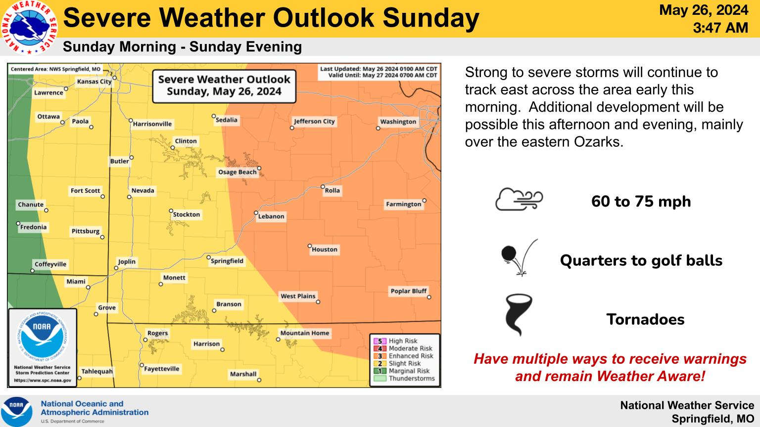
Tornados
While the National Weather Service has not reported and confirmed touch downs, NWS did confirm tornados in several areas. According to the reports filed, radar confirmed tornados were reported in Missouri in northeastern Taney County near Bradleyville which moved into southwestern Douglas County along with another confirmation in Ozark County near Willhoit. There were also confirmed tornados in Arkansas in Boone County near Olvey which damaged a home on Starkey Road and in Marion County near Pyatt with multiple trees and power lines down.
Power Outages
Marion County is one of the areas with a high number of power outages this morning. According to Entergy, several thousand people are still with out power with the highest concentration from southeast of Harrison to Mountain Home. Meanwhile, the Carroll Electric Cooperative is still reporting over 10,000 customers without power combined in both Arkansas and Missouri while both Liberty Utilities and White River Valley Electric Coop still reports some power outages this morning.
Wind/Hail
Strong winds as high as 70 MPH were reported during the storms knocking down many tree branches and winds plus many power poles contributing to the high number of power outages. Hail reports generally were one to two inches in diameter with slightly larger hail reported around Ridgedale near the Missouri-Arkansas line.
Flooding
Heavy rain also accompanied the storms and is still causing flooding this morning. A Flood Warning is in effect for Barry County including the Roaring River State Park area.
Sunday
Another round of severe weather is possible today with the strongest potential expected in south central Missouri and north central Arkansas. A Flood Watch is in effect for all of the Missouri Lakes Regionn for today.
 Arkansas AG Lawsuit Against Meta Can Continue in Part
 Amateur Radio Week in Branson
 Harrison Man Dies in Washington County Traffic Accident
 Harrison Considering the Formation of Historic District Commission