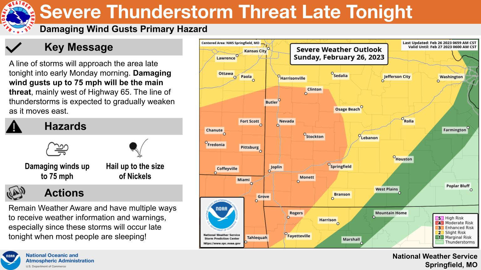
A noisy overnight i possible in the region with the potential for severe thunderstorms in the forecast.
The National Weather Service says a slight to enhanced risk of severe thunderstorms will be possible overnight with strong winds the primary threat. A Wind Advisory is in effect for this evening and overnight with wind gusts of 40-50 MPH possibly with storm related gusts of 70 MPH also possible. Areas west of Highway 65 are the most likely to see severe weather as storms are expected to weaken as the move east during the early morning hours. Nickel size hail is also possible with the passages of the storms.
Rain will clear out early Monday morning with warm days expected ahead of the next system expected in the area on Thursday.
 Front Storms Area, Brings End to Heat
 Springfield Murder Suspect Arrested in Lakes Region
 Final Hot Day Ahead of Front Bringing Cooler Temperatures, Rain
 One Person Injured in Fall Down Elevator Shaft
 Bell: Events All Through the Lakes Region are Good for Whole Area


